
Commitment to nature conservation
The detection of contaminated sites prior to maintenance measures
1.5 million – This high number of explosive ordnance is today still assumed to be in the ground of the abandoned military training area of Wittstock. Soviet troops and the German Bundeswehr used the site for all kinds of exercises, from shooting over tank attacks to aerial bombing, which ultimately gave the former bombing range its name (Bombodrom).

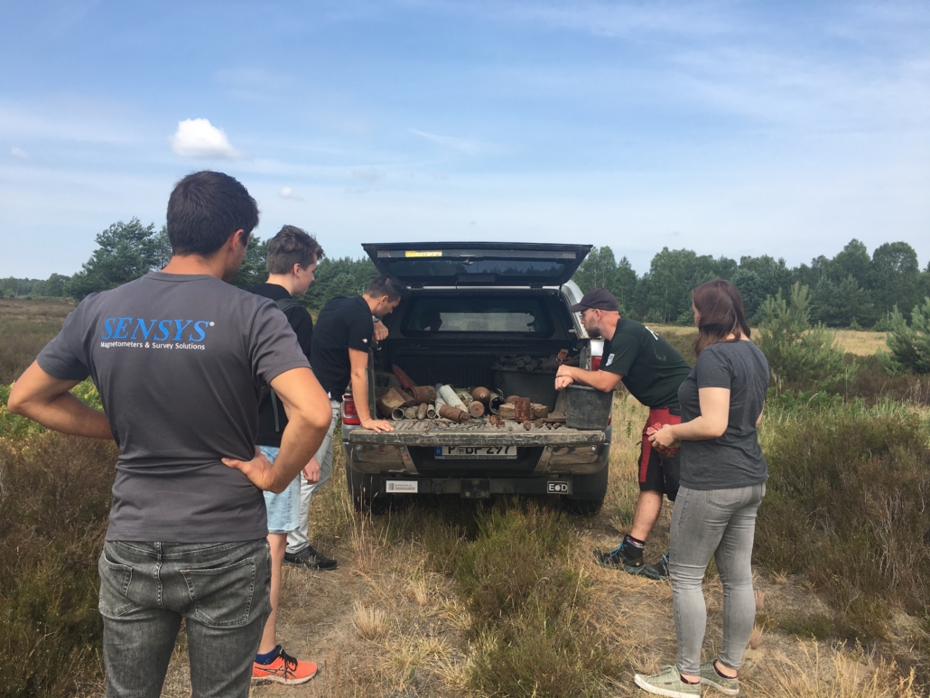
Sensys and Bundesforst are selecting amunition for a clearing campaign / © Goepfert, Heinz Sielmann Stiftung
Today, the 12.000 hectares of Kyritz-Ruppiner Heide are protected as nature reserve, but the open land biotopes need intensive care so that the important habitats for specialists are not lost. However, the deployment of machines or personnel on the ground is proving difficult: the data situation on the exact military exercises is patchy and thus the BImA (Germany’s Institute for Federal Real Estate), which is responsible for the care and maintenance, never quite knows what to expect when controlled burning, mowing or the removal of trees to keep the land open is planned. Currently, a wide wound strip is being cleared to prevent wildfires from spreading to the outer stands, and thus close to settlements, should the worst happen. The effort required for the first visual, then manual, probe-assisted search and subsequent recovery is enormous. Therefore, innovative solutions are needed in this field as well.
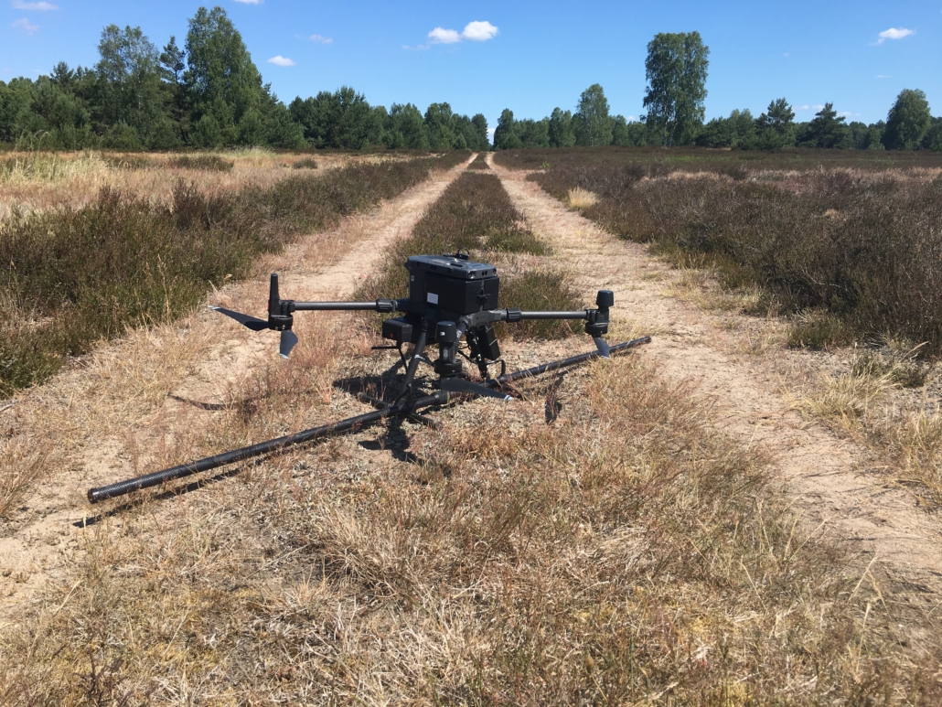
The problem is also relevant for nature conservation, since the preservation of heathland under Natura 2000 depends on consistently management measures. Therefore, the NaTec project tested the potentials of drone-based contaminated site detection. Within a cooperation with Sensys, a company that is engaged in the development and distribution of such solutions worldwide, an on-site test was carried out in June. A magnetometer survey kit on a drone was used to fly over an area of about 2.500 m2 that had been cleared years ago, but on which various ferrous objects have previously been laid out together with the BImA’s fire officer. The sensors are each located at a distance of 50 cm on a pole under the drone, enabling high-resolution mapping of the objects in the ground. These are then visible as a magnetic moment on a map, providing information on the location and spread, but not on the exact shape or material of the objects.
Drone with magnetometer – MagDrone by Sensys / © Goepfert, Heinz Sielmann Stiftung
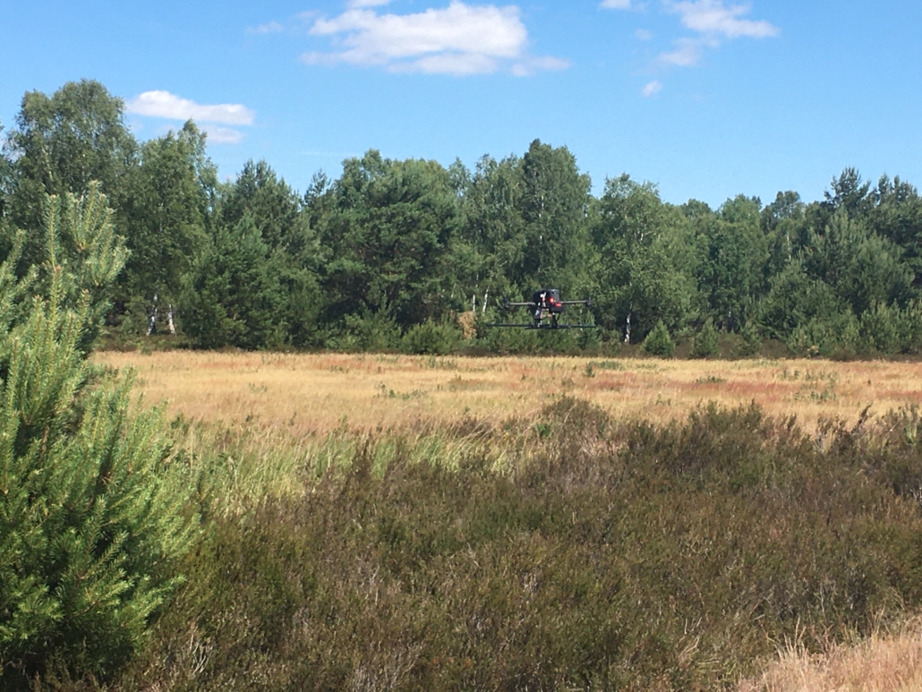
The lower the drone flies, the more objects can be detected. The application is limited by the growth on the ground, which is an obstacle for the drone. During two test flights at different heights, many objects could be detected, difficulties were only encountered with some munition of small size or iron content. Another test took place on the planned wound strip, which has already been mowed but not yet cleared. The follow-up will show how accurate and effective the maps obtained are and to what extent drone-assisted exploration can facilitate work on contaminated nature conservation areas. At the very least, large and particularly dangerous objects could be detected in this way, enabling a certain level of work operations, such as mowing with armored vehicles, to be carried out earlier and more cost-effectively than today.
In addition, maps of the last site will be used to detect any differences in vegetation among objects in the ground. If software programs could be used to determine certain features characteristic of locations where munition is above and below the surface, even an aerial survey with RGB or hyperspectral cameras could provide circumstantial evidence of contamination. Whether this is possible will be investigated in the coming months.
images & text by E. Goepfert & J. Burton (Heinz Sielmann Stiftung)


