
Spatially mapping landscape management and heather life cycles
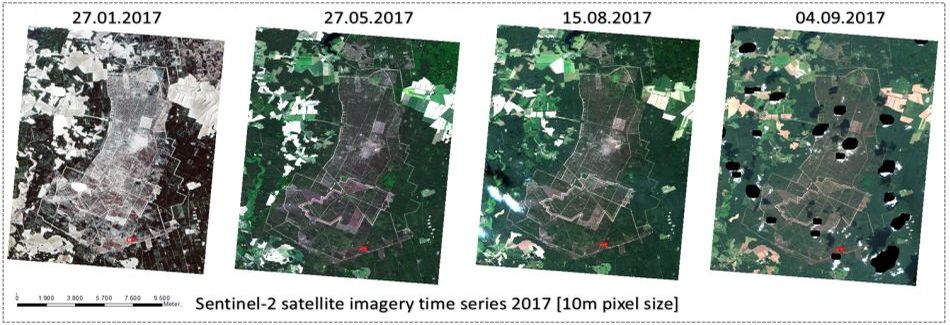
The European Space Agency’s (ESA) Copernicus Sentinel-2 program provides us with comprehensive and regularly updated data to monitor the areal extent, fragmentation and conservation status of large-scale habitat units. The project team developed a method for analysing the optical satellite time series to delineate habitat types such as Calluna heath, dry grasslands, fresh meadows and forest types. In addition, the satellite images can be used to distinguish and map different life cycle phases. Over time, the emergence of heather can be characterized following the application of landscape management measures in order to draw conclusions about the impact and effectiveness of the management.
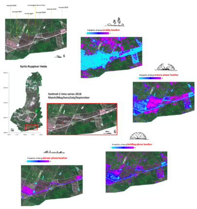
The process automatically assigns a life cycle and hit probability to the species Calluna vulgaris. In this way, old, degenerated heather stands, young growth as well as areas covered with bushes can be distinguished from each other and spatially mapped explicitly. Thus, areas in particular need of maintenance can be localized and landscape management can be coordinated in order to increase the efficiency of the management measures applied on site.landscape management can be coordinated in order to increase the efficiency of the management measures applied on site.
images & text by Dr. Carsten Neumann


